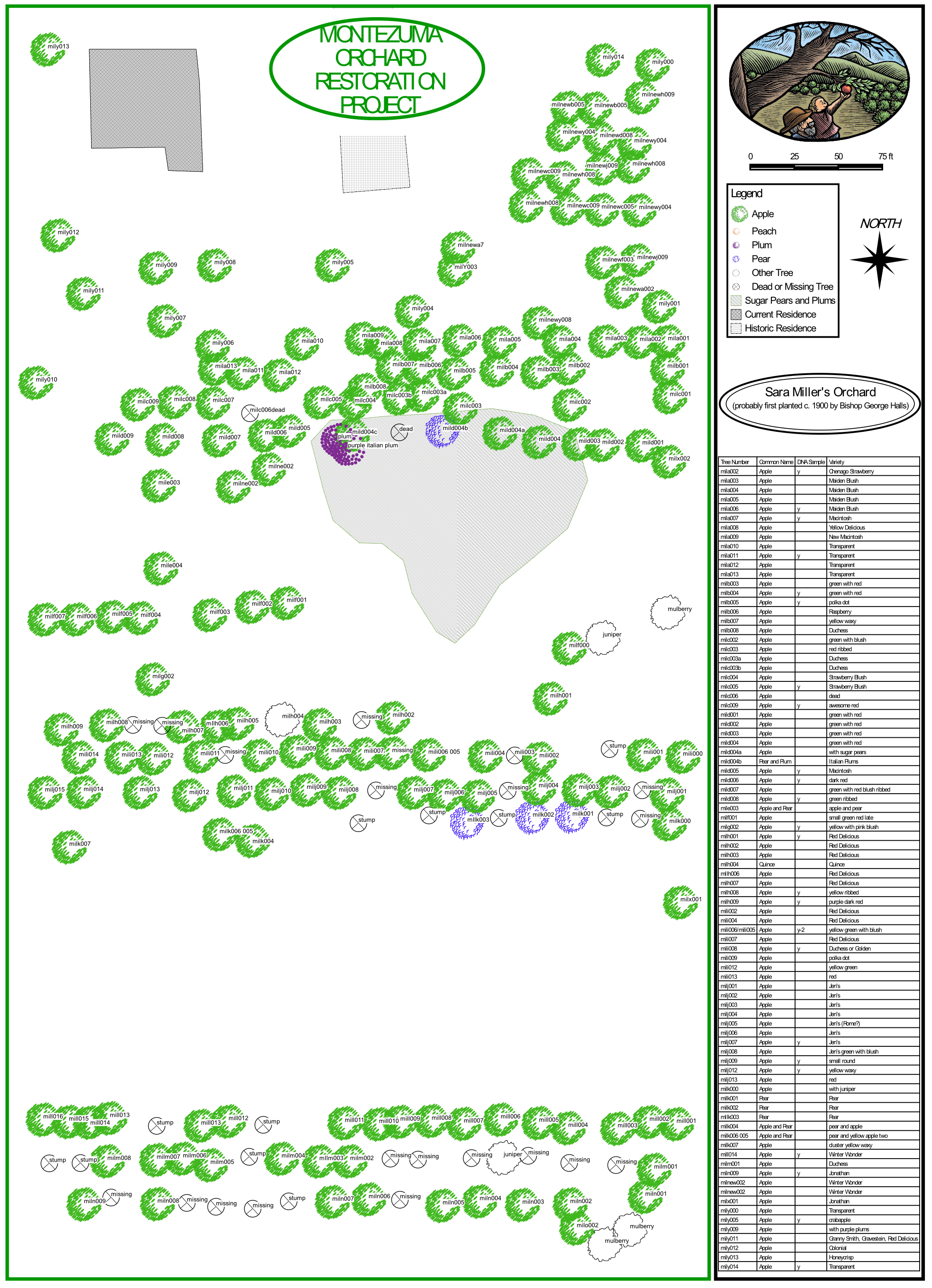
Mapping
We are actively seeking interested orchard owners that would like us to map and try to identify historic fruit trees on their land. We utilize modern, high accuracy Global Positioning System (GPS) and Geographic Information System (GIS) technology to develop a database of historic fruit trees and orchards. We also utilize this same technology to track the planting of newly grafted fruit trees, as we rebuild orchards in Montezuma County.